An In-depth Comparison Of Mapping Drones

When acquiring a mapping or surveying drone, the choice is quickly narrowed to a fixed-wing airplane combined with Vertical Takeoff and Landing (VTOL) for its vastly greater range, versatility and ease of use. Within this segment, there are several commercial-grade solutions of European origin. But comparing their capabilities and limitations can be difficult.
The following comparison was made to provide a detailed insight into the characteristics of the leading suppliers in this field. The data has been verified across multiple sources. Several aspects have been calculated to provide a consistent representation of the data. The calculation methods and sources are provided at the bottom of this article.
The platforms chosen for this comparison are:
- The DeltaQuad Pro #MAP by Vertical Technologies
- The WingtraOne by Wingtra
- The Trinity F90+ by Quantum Systems
- The Marlyn by AtmosUAV
- The eBee X by SenseFly
In the first section, you will find a quick overview of the most critical aspects relevant to any mapping or surveying solution. After that, you will find a full list comparing every known and relevant specification. Finally, the analysis includes a list of sources and references so that you may verify the objectivity of this comparison.
Key Features
A quick rundown of the most critical aspects that are relevant to mapping.
| DELTAQUAD PRO #MAP | WINGTRAONE | TRINITY F90+ | MARLYN | EBEE X | |
| Max. Flight Time | 110 minutes | 59 minutes | 90 minutes | 50 minutes | 60/90 minutes |
| Coverage At 3CM/PX | 1200 hectares | 450 hectares | 800 hectares | 360 hectares | 220/500 hectares |
| Max Control Range | 50 KM & Unlimited | 10 KM | 7 KM | 20 KM | 8 KM |
| Maximum Resolution Megapixel | 61 MP | 42 MP | 42 MP | 42 MP | 24 MP |
| Live Video | ✓ | X | X | X | X |
| Swappable Payloads | ✓ | ✓ | ✓ | X | ✓ |
| Comparative Package Price | € 19.593 | € 29.600 | € 21.990 | € 29.450 | € 22.550 |
- Max flight time is calculated at sea level with camera payload.
- The coverage is calculated by multiplying the maximum flight distance by the maximum camera resolution. It is based on 3CM per pixel with an overlap of 50%.
- To compare pricing a package was selected for each model that most closely resembles: 42MP camera, <1CM PPK, 2 Batteries, Standard radio, GCS (if available).
| Maximum surveying area in Hectares | |
| The maximum area that can be mapped in a single flight is determined by several factors such as camera resolution, cruise speed, endurance, and lens options.This comparison is based on the highest resolution offered for each platform, combined with the maximum flight distance. The values have been calculated based on 3cm per pixel resolution and a 50% image overlap. The values have then been compensated to account for the camera’s minimum trigger interval. |  |
| Maximum telemetry range | |
| The maximum range at which the UAV can be controlled. Long-range communications is important for corridor-type surveys such as power lines, pipelines, railways, and roads.The indicated ranges are the maximum radio range as specified by the supplier. Nominal ranges can be lower. |  |
| Maximum image resolution | |
| The maximum image resolution in Megapixels is the total number of pixels that make up a single image. This can be an important factor for a fixed-wing/VTOL UAV.A higher resolution allows:– Covering larger areas– Flying at higher altitudes– Producing higher resolution end results– Better post-processing performance with more accuracy | 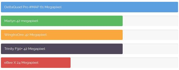 |
Maximum flight time
| The maximum flight time for fixed-wing UAV depends on the altitude above sea level. As the altitude increases, the UAVs need to fly faster due to a lower air density. However, the lower air density also provides less drag, therefore in most cases the maximum flight distance remains the same at all altitudes.The indicated maximum flight times are at sea level while carrying a regular camera payload. |  |
In-depth comparison
In this section, all aspects of the selected platforms are compared. Most aspects are based on the published specifications by the manufacturers. Some aspects were derived or calculated. At the bottom of this article you will find an explanation of the calculation methods.
| Platform Specifications | |||||
| DELTAQUAD PRO #MAP | WINGTRAONE | TRINITY F90+ | MARLYN | EBEE X | |
| Country Of Origin | The Netherlands | Switzerland | Germany | The Netherlands | Switzerland |
| Platform Type | Redundant Vtol | Vtol Tailsitter | Vtol Tiltrotor | Vtol Tailsitter | Fixed-wing |
| Cruise Speed | 16m/S | 16m/S | 17m/S | 14m/S | 11m/S |
| Max. Flight Time | 110 Minutes | 59 Minutes | 90 Minutes | 50 Minutes | 60/90 Minutes |
| Max. Flight Distance (Cruise * Time – 10%) | 100km | 50km | 90km | 40km | 55km |
| Payload Capacity | 1200g | 800g | 700g | 800g | 800g |
| Radio Range | 20km/30km/50km LTE (Unlimited) | 10km | 7km | 7km/20km | 8km |
| Live Mapping Video | ✓ | X | X | X | X |
| Zero Pre-flight Calibrations | ✓ | X | X | X | ✓ |
| 4G/LTE Support | ✓ | X | X | X | X |
| FPV Video Support | ✓ | X | X | X | X |
| Swappable Payloads | ✓ | ✓ | ✓ | X | ✓ |
| Supported Cameras | 61MP Sony A7R-IV42MP Sony A7R-III42MP Sony RX1R-II24MP Sony A6000Micasense Rededge MxMicasense AltumFlir Duo Pro R | 20MP Sony QX142MP Sony RX1R IIMicasense Rededge-mxMicasense Altum | 20MP Sony UMC42MP Sony RX1R IIMicasense Rededge-mxMicasense Altum | 42MP Sony RX1RII42MP A7CMicasense Rededge-mxMicasense Altum | 24MP AREAX20MP SODAParrot SequoiaMicasense Rededge Mx |
| Mapping Performance | |||||
| DELTAQUAD PRO #MAP | WINGTRAONE | TRINITY F90+ | MARLYN | EBEE X | |
| Maximum Image Resolution | 61 Megapixel | 42 Megapixel | 42 Megapixel | 42 Megapixel | 24 Megapixel |
| Coverage At 3CM/PX | 1200 Ha | 450 Ha | 800 Ha | 360 Ha | 220ha/500 Ha |
| Maximum Corridor Length | 50 Km | 5 Km | 7 Km | 20 Km | 8 Km |
| Lowest GSD | 0.4 CM/PX | 0.7 CM/PX | 0.7 CM/PX | 0,85 CM/PX | 1.0 CM/PX |
| RTK/PPK Setup | |||||
| DELTAQUAD PRO #MAP | WINGTRAONE | TRINITY F90+ | MARLYN | EBEE X | |
| GPS Band | L1 & L2 | L1 & L2 | L1 | L1 & L2 | L1 |
| Precision | <1cm | <1cm | >3cm | <1cm | >3cm |
| Base Station Available | ✓ | X | ✓ | X | ✓ |
| Software Features | |||||
| DELTAQUAD PRO #MAP | WINGTRAONE | TRINITY F90+ | MARLYN | EBEE X | |
| Smart Mission Planning | ✓ | ✓ | ✓ | ✓ | ✓ |
| Smart Mission Plan Validation | ✓ | X | X | X | X |
| Flight Simulator | ✓ | X | X | X | ✓ |
| Terrain Following | ✓ | ✓ | ✓ | X | ✓ |
| Automated Takeoff & Land | ✓ | ✓ | X | ✓ | X |
| Safety Features | |||||
| DELTAQUAD PRO #MAP | WINGTRAONE | TRINITY F90+ | MARLYN | EBEE X | |
| Redundant Flight System | ✓ | X | X | X | X |
| ADS-B | ✓ | ✓ | ✓ | X | ✓ |
| Live Nose Camera (FPV) | ✓ | X | X | X | X |
| Tolerances | |||||
| DELTAQUAD PRO #MAP | WINGTRAONE | TRINITY F90+ | MARLYN | EBEE X | |
| Maximum Wind | 45 Km/H | 40 Km/H | 43 Km/H | 45km/H | 35 Km/H |
| Max. Takeoff & Landing Wind | 33 Km/H | 30 Km/H | 33 Km/H (25km/H above 1500m) | 45km/H (Unverified) | 35km/H |
| Max. Takeoff Altitude | 4000m | 2500m | 4000m | 4000m | 5000m |
| Temperature Range | -20 To +45 C | -10 To +40 C | -12 To +50 C | -10 To +40 C | -15 To + 40c |
| Handling | |||||
| DELTAQUAD PRO #MAP | WINGTRAONE | TRINITY F90+ | MARLYN | EBEE X | |
| Setup Time | 1 Minute | 5 Minutes | 7 Minutes | 5 Minutes | 10 Minutes |
| Control Type | Integrated Touch-screen Controller with Mission Planning, Live video, and Manual Control Joysticks | Analog Controller | Analog Controller | Analog Controller | Analog Controller |
| Ground Control Station Options | Integrated ControllerTabletField LaptopCommand Center Integration | Tablet | Not Included A Laptop Is Required To Operate | Not Included A Laptop Is Required To Operate | Not Included A Laptop Is Required To Operate |
| Autonomy | Full MappingTakeoffLanding | Full MappingTakeoffLanding | Semi MappingTakeoff | Full MappingTakeoffLanding | Semi Mapping |
| Manual Override | Assisted Manual Control In Fixed Wing And Hover Flight | Manual Control In Fixed Wing And Hover Flight | Manual Control In Hover Flight Only | Manual Control In Fixed Wing And Hover Flight | Manual Control In Fixed Wing Only |
| Takeoff Weight | 6.2 Kg | 4.5 Kg | 5.0kg | 6.7kg | 1.6kg |
| Wing Span | 235 Cm | 125 Cm | 239cm | 160cm | 116cm |
| Transport case | Rugged Flightcase | Backpack | Soft Case | Soft Case Rugged optional | Soft Case |
| Costs ComparisonPricing for the most resembling packages | |||||
| DELTAQUAD PRO #MAP | WINGTRAONE | TRINITY F90+ | MARLYN | EBEE X | |
| Package Contents | UAV2 Batteries1cm PPK42mp RX1RII20km Radio LinkTablet | UAV2 Batteries1cm PPK42mp RX1RII10km Radio LinkTablet | UAV2 Batteries3cm PPK42mp RX1RII7km Radio Link | UAV2 Batteries1cm PPK42mp RX1RII7km Radio Link | UAV2 Batteries3cm PPK24mp Areax8km Radio Link |
| Comparative Package Price | € 19.593,00 | € 29.600,00 | € 21.990,00 | € 29.450,00 | € 22.550,00 |
| Options & Pricing | |||||
| DELTAQUAD PRO #MAP | WINGTRAONE | TRINITY F90+ | MARLYN | EBEE X | |
| Platform Price | € 9.999,00 | € 15.755,89 | € 15.900,00 | € 16.950,00 | € 14.000,00 (90KM) |
| Battery | € 499,00 | € 420,00 | € 640,00 | unknown | € 400 |
| PPK 3cm | € 899,00 | not available | included | not available | € 4.950 |
| PPK 1cm | € 1.299,00 | included | not available | +- € 7.500 | not available |
| PPK Base Station | € 2.600,00 | not available | not available | not available | € 5.350 |
| Transmission System | 20KM+Tablet: € 1.299 30KM + integrated controller: € 3.499 50KM + integrated controller: € 5.499 | 10KM+Tablet: included | 7KM: included | 7KM: included 20KM: unknown | 7KM: included |
| Live Mapping and FPV Video | Included with integrated controller option | not available | not available | not available | not available |
| 4G/LTE Control and Video | Included with integrated controller option | not available | not available | not available | not available |
| 61mp Sensor (Sony A7R4) | € 6.699,00 | not available | not available | not available | not available |
| 42mp Sensor (Sony RX1RII) | € 5.299,00 | € 6.500,00 | € 5.450,00 | +- € 7.000 | not available |
| 20mp/24mp Sensor | € 1.299,00 | € 2.100,00 | € 2.290,00 | not available | € 3.600 |
| Micasense Rededge MXWith DLS & Calibration Panel | € 7.299,00 | € 5.900 (without DLS) | € 6.890,00 | +- € 8.000 | +- € 8.000 |
| Micasense Altum With DLS & Calibration Panel | € 12.999,00 | € 12.100,00 (without DLS) | € 12.750,00 | +- € 13.000 | not available |
| Flir Duo Pro R | € 7.900,00 | not available | not available | not available | not available |
| Lidar + Software | not available | not available | € 60.100,00 | not available | not available |
| SOURCES | |||||
| DELTAQUAD PRO #MAP | WINGTRAONE | TRINITY F90+ | MARLYN | EBEE X | |
| Pricing | DeltaQuad configurator | Wingtra Configurator | Price list | Quotation Reseller | Reseller |
| Specifications | DeltaQuad specifications | Wingtra specifications | User manual | Spec list GeoMatching | SenseFly specs |
Calculation methods
Maximum flight time
The maximum flight time is based on flying at sea level. The DeltaQuad, Wingtraone and eBee X indicated their flight time is based on carrying the standard mapping payload. The Trinity F90+ and Marlyn did not specify this.
Maximum flight distance
The maximum flight distance is calculated by multiplying the cruise speed by the max flight time, and reducing the value by 10% to accomodate for takeoff and landing. The calculation was done this way as not all manufacturers use the same method for specifying the maximum flight distance.
Maximum surveying Area
This comparison is based on the highest resolution offered for each platform, combined with the maximum flight distance. The values have been calculated based on 3cm per pixel resolution and a 50% image overlap. The values have then been compensated to account for the camera’s minimum trigger interval.
Setup time
Assembly and pre-flight calibration time was either specified and/or determined by watching operation videos for different platforms.
Maximum wind
The maximum wind was calculated based on the supplier specification. It was then limited by cruise speed, and reduced with 5 meters per second to allow sufficient forward flight for mapping.
This value should be based on sea level as wind tolerance increases at higher altitudes. It seems that not all suppliers are listing these values at sea level.
Comparative package price
A price was requested for all platforms based on the Following specifications:
– 42MP camera
– 1CM PPK (if available)
– 2 Batteries
– Standard radio solution
– Ground Control Station (if available)
The Trinity F90+ and eBee X do not provide <1CM PPK
The Trinity F90+, Marlyn and eBee X do not provide a Ground Control Station
The Trinity F90+ comes with a 3CM PPK base station included
Disclaimer
The data in this comparison has been carefully verified across multiple sources, nevertheless inaccuracies can occur. Please verify all aspects with the platform suppliers. This article is for information purposes only, no rights can be derived from this data.
Discover more from sUAS News
Subscribe to get the latest posts sent to your email.


